EN
EN



Tour
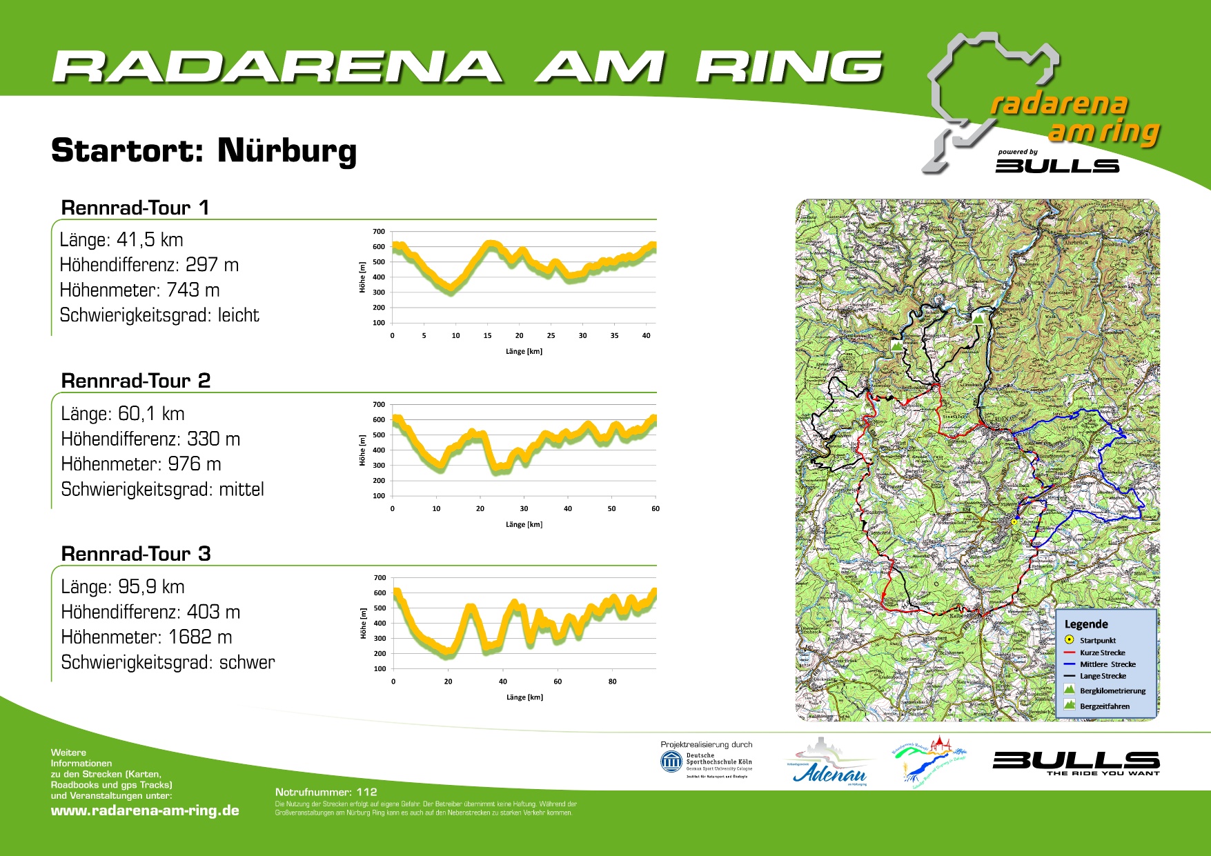
Radarena am Ring: Start in Nürburg, Road bike route 3
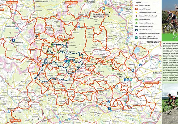
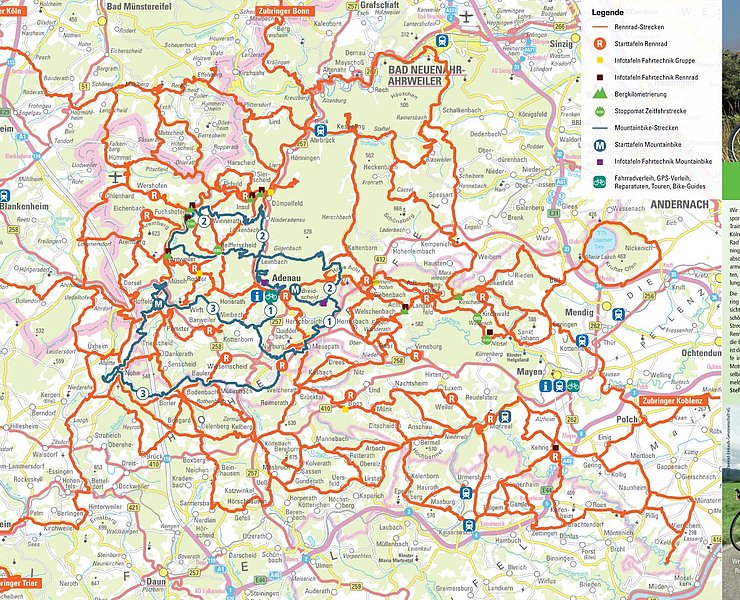
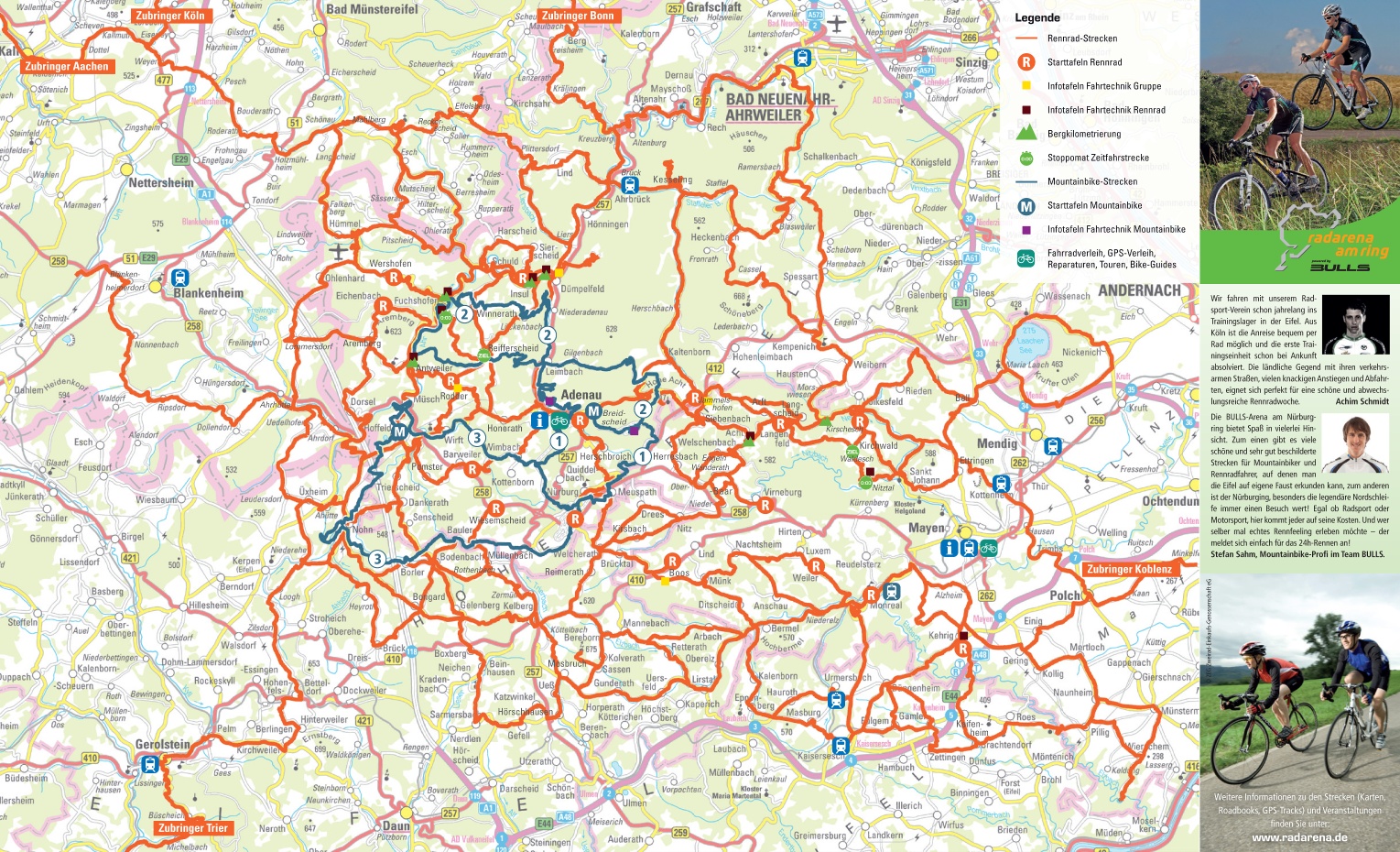
The cycle path network of the Radarena am Ring and many quiet roads in beautiful countryside offer great opportunities for cyclists of all kinds. Flat routes through river valleys and along former railway tracks contrast with the hilly low mountain range landscape. Extreme climbs are found in the area around the Nürburgring and the Hohe Acht.
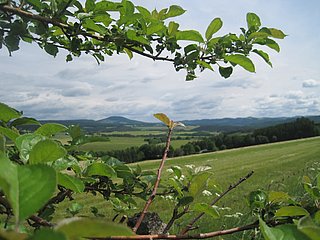
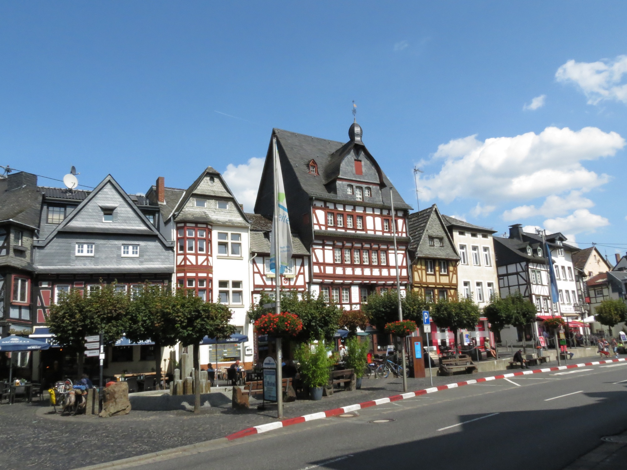
From the starting point in Nürburg, the route first goes steadily downhill through the historic town center of Adenau, then after a short break behind Dümpelfeld goes steeply uphill again towards the elevated village of Reifferscheid. The route impresses with the special charm of the wild romantic High Eifel region with wonderful panoramic views.
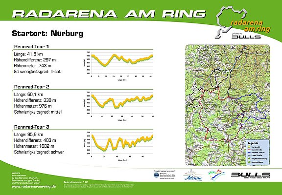
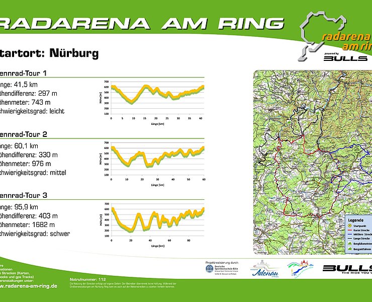
The total distance is 95.9 km with an altitude gain of 1682 m. The altitude difference is 403 m.
The route is classified as "difficult".
Further routes in the Radarena am Ring starting from Nürburg are possible:
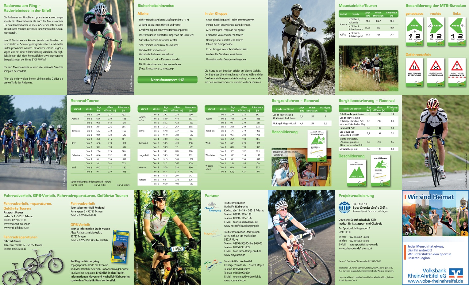
- Road bike route 1: Length 41.5 km, difficulty level easy
- Road bike route 2: Length 60.1 km, difficulty level medium
Route: Nürburg – Herschbroich – Adenau – Dümpelfeld – Reifferscheid – Rodder – Antweiler – Müsch – Hoffeld – Trierscheid – Dankerath – Bodenbach – Bongard – Kelberg – Hünerbach – Reimerath – Welcherath – Meuspath – Nürburg
0.0 Start (and finish): Nürburg, info°center straight ahead on B258 towards Nürburg km 0.5 Nürburg (Zakspeed) left onto Hauptstraße/L93 towards Nürburg km 1.0 Nürburg (junction K73 towards Quiddelbach) straight on (remain on Hauptstraße) km 2.3 roundabout Nordschleifenzufahrt straight towards Adenau (remain on L93) km 2.8 junction K20 straight towards Adenau (remain on L93) km 3.6 junction L92 left onto L92 towards Adenau km 6.2 junction K21 right onto K21 towards Herschbroich km 8.3 junction B257 right onto B257 towards Adenau km 9.3 crossing B257/L10 (Radsport Breuer) straight onto Hauptstraße/B257 towards Adenau km 11.2 Adenau town end (junction behind DRK Adenau) first right then left into Am Alten Wehr (parallel to the federal road) km 12.3 end of Adenau industrial area left onto cycle path (behind turning circle) km 12.4 cycle path junction right onto cycle path towards Leimbach km 13.8 Leimbach town centre straight over B257 onto cycle path km 16.8 Niederadenau town entrance left into Wiesenweg/cycle path km 18.5 Dümpelfeld town centre right into Hauptstraße, then left into Ahrstraße/cycle path km 18.8 Dümpelfeld town exit left onto cycle path, then left towards Insul km 20.5 Insul town entrance left into Brückenstraße km 20.8 Insul town centre left into Hauptstraße/L73 towards Dümpelfeld km 21.4 junction K24 right onto K24 towards Lückenbach km 23.9 Lückenbach town exit/chapel straight onto K24 towards Reifferscheid km 26.8 junction agricultural path straight onto K24 towards Reifferscheid km 27.4 Reifferscheid town entrance right into Euskirchener Straße/K16 towards Schuld km 33.5 Schuld town centre/church left into Hauptstraße/L73 km 33.9 Schuld (junction Bergstraße/K26 towards Harscheid) straight onto Hauptstraße/L73 towards Fuchshofen km 34.6 junction Münstereifeler Straße/L75 left towards Fuchshofen (stay on L73) km 37.6 junction L74 left towards Fuchshofen (stay on L73) km 38.5 Fuchshofen town entrance left into Hauptstraße/K17 towards Reifferscheid km 44.6 Reifferscheid town centre right into Rodderweg/K16 towards Rodder km 46.7 Rodder town centre right into Rosenstraße/K15 towards Antweiler km 50.1 Antweiler right into Ahrtalstraße/L73 towards Schuld km 50.2 Antweiler town centre left into Aremberger Straße/K6 towards Aremberg km 53.2 junction Lenzenhof/K5 left into Lenzenhof/K5 towards Dorsel km 59.2 crossing K5/B258 right to Dorseler Mühle km 60.1 turn left, after Ahr bridge turn right onto cycle path towards Ahrdorf km 61.6 crossing cycle path/country road left onto L167 towards Nohn km 64.5 junction L10 left onto L10 towards Adenau km 66.5 junction K4 (Hoffeld) right (stay on L10) km 67.2 junction L72 right onto L72 towards Trierscheid km 70.8 junction K1 (Dankerath) left onto L72 towards Senscheid km 75.1 Bodenbach straight onto Hauptstraße/K65 towards Bongard km 75.5 Bodenbach left into Gelenberger Weg/L72 towards Gelenberg km 78.8 crossing L72/L70 left onto L70 towards Kelberg km 83.3 Kelberg right into Bonner Straße km 83.5 Kelberg town centre left into Mayener Straße towards Ulmen km 83.9 Kelberg roundabout straight onto Mayener Straße/B410 towards Hünerbach km 85.7 Hünerbach left into Zum Ring/K89 towards Reimerath km 89.5 Welcherath town entrance straight into Hauptstraße km 89.7 Welcherath town centre left onto Hauptstraße towards Meuspath km 90.0 Welcherath town exit right onto K89 towards Meuspath km 93.1 Meuspath town entrance left into Antoniusweg towards Nürburg km 93.3 Meuspath town exit straight on Antoniusweg towards Nürburg km 94.2 Antonius bridge right over Antonius bridge (crossing B256 and Nordschleife), then left into Kirchweg towards Nürburg km 94.9 Nürburg left into Hauptstraße/L93 towards welcome°center km 95.5 Nürburg (Zakspeed) right onto B258 towards info°center km 95.9
End of route: Nürburg, info°center
Note: Route adjustment due to destroyed Ahr bridge Dorsel/Stahlhütte initially via B258 towards Dorseler Mühle bridge (1 km)


- Racing bike
- Cycling

source
Eifel Tourismus GmbH
·
Author:
Daniela Schmitz / Tourist-Information Hocheifel-Nürburgring