 EN
EN


AhrSchleifen
7 new circular & walking trails on the AhrSteig
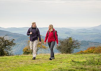
Seven new circular hiking trails expand the hiking offer around the popular AhrSteig. The so-called AhrSchleifen invite you to discover new hiking trails in the Ahr Valley - off the beaten track, but always surrounded by the impressive landscape along the Ahr. Thanks to a mixture of three short walking trails and four challenging circular hiking trails, every hiking enthusiast will find the right tour here.
What all AhrSchleifen have in common:
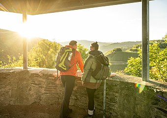
The new, well-signposted circular tours show you the diversity of nature that the Ahr Valley has to offer. They allow you to discover the different regions of the upper, middle and lower Ahr. Forests, meadows, vineyards, panoramic views: immerse yourself in the different landscapes, which enchant you with their very own charm depending on the season.
Discover the new AhrSchleifen and look forward to very special hiking perspectives in the Ahr Valley!

AhrSchleife Köhlerweg
- Region: Upper Ahr Valley
- Start/Finish: Old schoolyard, Müsch
- Character: Circular hiking trail
- Length: approx. 11.8 kilometres
- Ascent/descent: 388 metres
- Walking time: approx. 3:25 hours
- Difficulty: medium
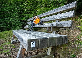
- Highlights: XXL bench Müsch, charcoal pit, panoramic bench Müsch, Aremberg (highest mountain in the Ahrgebirge), Arenberg castle and palace ruins, Müsch inclusion garden


AhrSchleife Köhlerblicke
- Region: Upper Ahr Valley
- Start/Finish: Old schoolyard, Müsch
- Character: walking trail
- Length: approx. 3.6 kilometres
- Ascent/descent: 97 metres
- Walking time: approx. 1:05 hours
- Difficulty: easy
- Highlights: XXL bench Müsch, Köhlergrube, panorama bench Müsch, inclusion garden Müsch
- Also available as a listening tour from autumn 2026


AhrSchleife Steinerberg
- Region: Mittelahr
- Start/Finish: Ahrbrück railway station
- Character: Circular hiking trail
- Length: approx. 16.8 kilometres
- Ascent/descent: 456 metres
- Walking time: approx. 5:10 hours
- Difficulty: difficult
- Highlights: Silvesterhütte, views into the Ahr valley and over the Eifel heights, Steinerberghaus, Kesselinger Tal, Pützfeld chapel


AhrSchleife WeinBergBlicke
- Region: Bad Neuenahr-Ahrweiler
- Start/Finish: Quarzkaul hiking car park, Ahrweiler
- Character: Circular hiking trail
- Length: approx. 14.7 kilometres
- Ascent/descent: 456 metres
- Walking time: approx. 4:30 hours
- Difficulty: difficult
- Highlights: Maibachklamm gorge, Katzley viewpoint, Flutkapelle chapel, Walporzheim vineyard terraces, Bunte Kuh viewpoint, Eva tower, Ahrweiler vineyards


AhrSchleife Im Maibachtal
- Region: Bad Neuenahr-Ahrweiler
- Start/Finish: Quarzkaul hiking car park, Ahrweiler
- Character: walking trail
- Length: approx. 5.5 kilometres
- Ascent/descent: 144 metres
- Walking time: approx. 1:30 hours
- Difficulty: easy
- Highlights: Maibachklamm gorge, Maibachfarm organic vineyard, Ahrweiler vineyards, Monastery Calvarienberg


AhrSchleife RheinAhrSicht
- Region: Lower Ahr
- Start/Finish: Ahrbrücke car park, Sinzig
- Character: Circular hiking trail
- Length: approx. 15.3 kilometres
- Ascent/descent: 314 metres
- Walking time: approx. 4:05 hours
- Difficulty: difficult
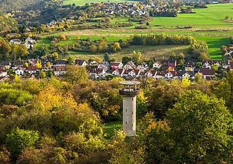
- Highlights: View from the Feltenturm tower, Schwanenteich animal enclosure, banks of the Ahr in Bad Bodendorf, panoramic views over the Rhine and Ahr valleys, Ehlingen winegrower's cottage
The perfect complement:
EifelSpur "Where the Ahr springs"
- Region: Blankenheim
- Start/Finish: Curtius-Schulten-Platz Blankenheim
- Character: Circular hiking trail
- Length: approx. 15.8 kilometres
- Ascent/descent: 390 metres
- Walking time: approx. 5 hours
- Difficulty: medium
- Highlights: Ahr spring in the half-timbered house in Blankenheim, historic centre of Blankenheim, Upper Ahr nature reserve




Marking
The green marking stands for varied circular hiking trails with a length of 12 to 17 kilometres. They are ideal as day tours with a high adventure factor.
The purple markings indicate short walking trails of up to 7 kilometres in length. These circuits are particularly family-friendly and ideal as relaxed half-day tours.


Discover the AhrSteig
All service topics, route changes, hosts, places and sights around the AhrSteig can be found in detail on the AhrSteig website. Here you will also find information about the AhrSteig hiking pass, the top viewpoints and hiking with luggage transfer.

