EN
EN

Wanderweg
Over the heights of Ahrweiler
The hiking route up the heights south of Ahrweiler leads through diverse mixed forest, past the secluded Antonius chapel in the woods and offers beautiful viewpoints at the observation tower on the Steinthalskopf and the pavilion at Katzley. Several benches and shelters invite you to rest along the way. The first half of the route contains some uphill sections.
There is no opportunity to eat or drink during the hike, only at the end in Walporzheim. The hike is suitable for children.
From the hiking parking lot, you first follow the AhrSteig, initially going downstream parallel to the Ahr, then soon right into the side valley of the Wingsbach. This path through the romantic Maibachklamm leads over 13 bridges along the stream to the parking lot Quarzkaul (1.5 km), where you leave the AhrSteig continuing to the left. The hiking path follows the road to the right towards Maibachfarm and after 200 m turns half-right onto the ascending forest path. Two paths branching right are passed and the left-descending cross path at the bench is crossed. Here you follow the small sign Antoniuskapelle, as well as at the next crossroads, where the hiking path turns left. The forest path through open mixed forest steadily leads uphill and offers beautiful views; at the next crossroads you hike uphill through the hollow path opposite to the secluded Antoniuskapelle (415 m, 3.8 km). This recently renovated chapel is dedicated to Saint Anthony of Padua; its origin is not clearly explained. Ringing the bell is explicitly desired!
It goes another 200 m uphill, at the following cross path you turn left. After 1.1 km hiking on a wide forest path you reach a path star on the Ahr-Venn-Weg of the Eifelverein, but here you do not yet follow it to the right uphill, instead go straight ahead on the road for 250 m and only then turn right onto the Ahr-Venn-Weg. Soon after, at the shelter Häuschen Turm (507 m, 5.8 km), the highest point of the hike is reached. Until a few years ago, there was a wooden observation tower here, which was demolished due to structural instability.
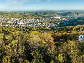
For the next stretch, follow the trail mark A8 and hike on a wide, level forest path through an open pine forest with heathland to the Steinthalskopf (418 m, 7.6 km) with shelter and observation tower. The observation tower on the second highest hill in the Ahrweiler city area was named after the former district archivist and local historian Jakob Rausch. From the hut, a short path leads to the tower, where the view worth seeing includes the Ahr valley, the Krausberg, and the vineyards opposite!
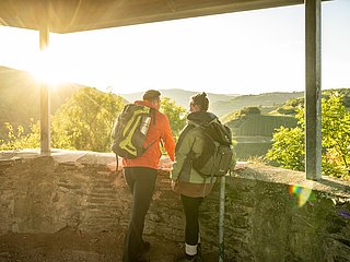
Continue on the descending path (R16), after 700 m turn right onto the hillside path and stay on the consistently gently descending path (R16) until the sharp right curve. Here follow the sign To Katzley. Over a short, somewhat bumpy path (R17), the viewing pavilion at Katzley (220 m, 9.7 km) is quickly reached. The pavilion, inviting for relaxation, offers a magnificent view into the Ahr valley, to the volcanic cones of Landskrone and Neuenahrer Berg, to the Rhine with the Siebengebirge, as well as to the opposite Ahr side to the striking slate slab Bunte Kuh and the pavilion with the same name located above it.
For the further route, go back 50 m to the path branching left (R17). In 6 loops this switchback path quickly descends to the Ahr, and on the AhrSteig-Verbindungsweg (AV1+2), walking to the right, the starting point at the hiking parking lot Josefbrücke is soon reached again.
- ZG Vielseitig Aktive (L)
- ZG Aktive Naturgenießer (L)
- ZG Kultur- und Landschaftsliebhaber (L)
- ZG Nur Wanderer (L)
- ZG Städte-Genießer (L)
- Round trip
- Hiking trail
- Family friendly
- Botanical highlights
- promising
- Hiking

source
Ahrtal-Tourismus Bad Neuenahr-Ahrweiler e.V.
·
Author:
Eifelverein Ahrweiler, Heinz Ahrendt